| Trailhead in | Appenzell, Switzerland |
| Started on | Jun 12, 2016 at 09:00 |
| Weather | sunny |
| Hikers | J, L |
| Effort | medium |
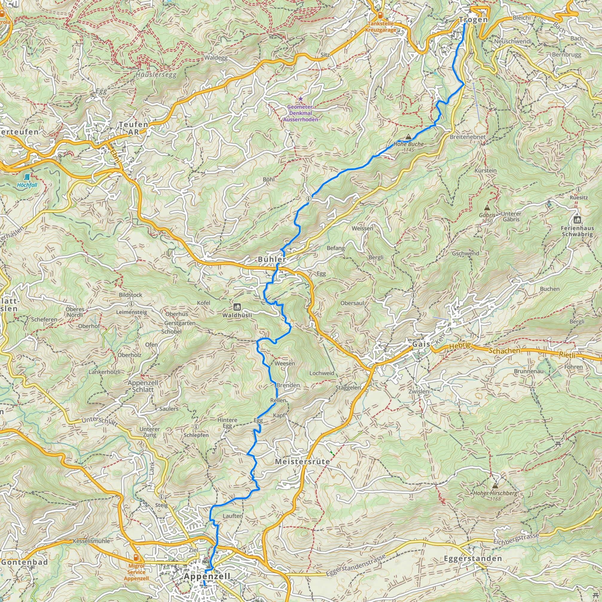
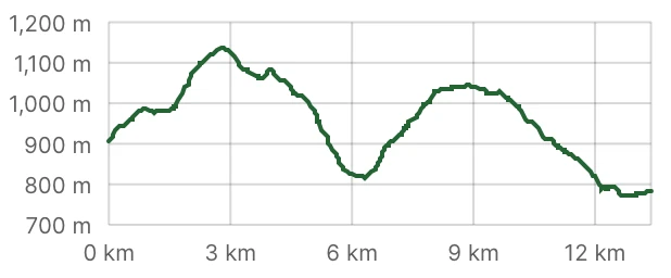
| Distance | 13.4 km |
| Files | GPX |
| Elevation | |
|---|---|
| Slope | ↗4% |
| Ascent | 515 m |
| Descent | 634 m |
| Max Elevation | 1138 m |
| Min Elevation | 771 m |
| Time | |
| Total Time | ~5h |
| Moving Time | ~4h |
On Sunday we escaped the intense rain that was falling over most of Switzerland. This time we tried a new national route, stage 2 of Alpenpanorama Trail, as it passes through the smallest canton of Switzerland, Appenzell. The name means “cell (state) of the abbot (of St. Gallen)” and religion had indeed a strong influence in its history: the canton is divided into two parts, the Protestant one and the Catholic one, and the capital. Appenzell is also completely surrounded by another canton, St. Gallen, because at some point in the 1300s the abbot of St Gallen taxed the people of Appenzell too much, they rebelled and eventually they became independent. The canton also has a fame of being the most conservative in the country.
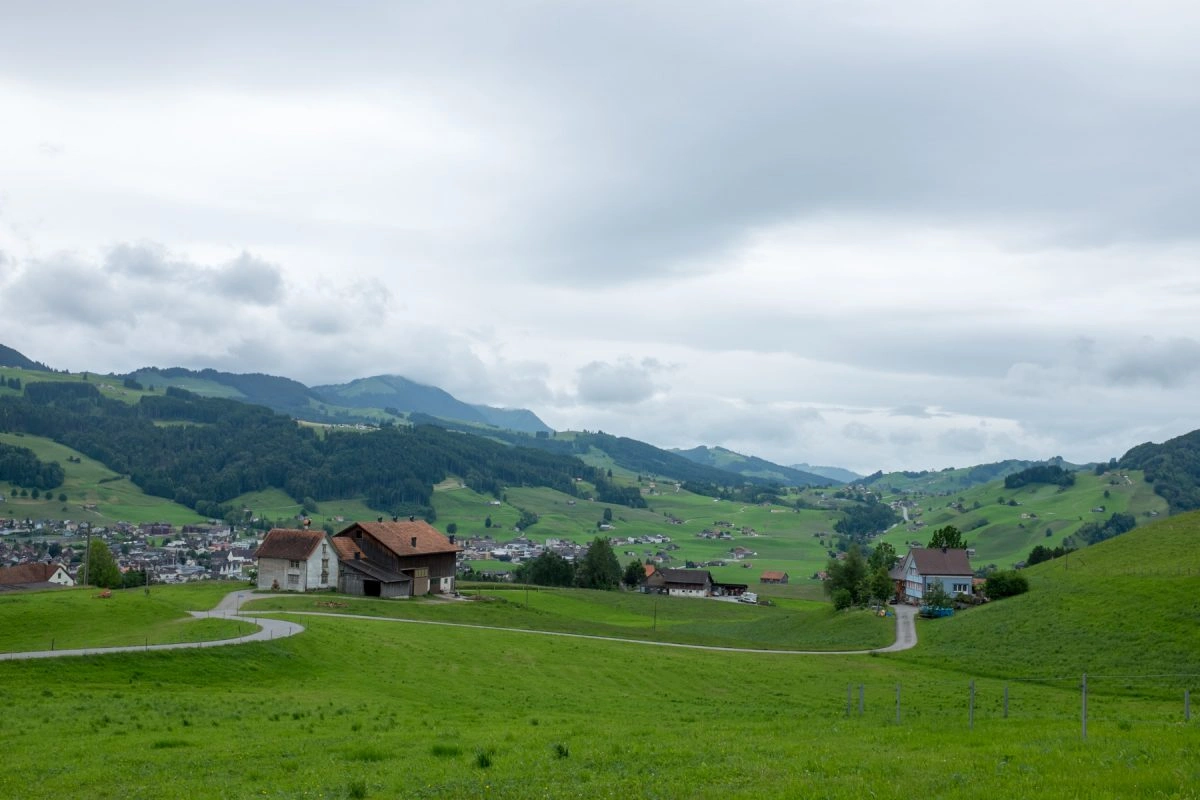
We started the hike in Trogen, the capital of the Protestant part, and a place best known for its Kinderdorf Pestalozzi (Pestalozzi Children Village), an organization established in 1946 to accommodate and educate children affected by war. Whoever planned the Alpenpanorama trail had the great idea of making it pass next to the village so that was our first sight of the day.

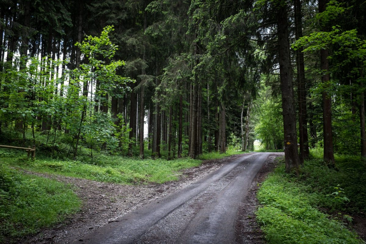
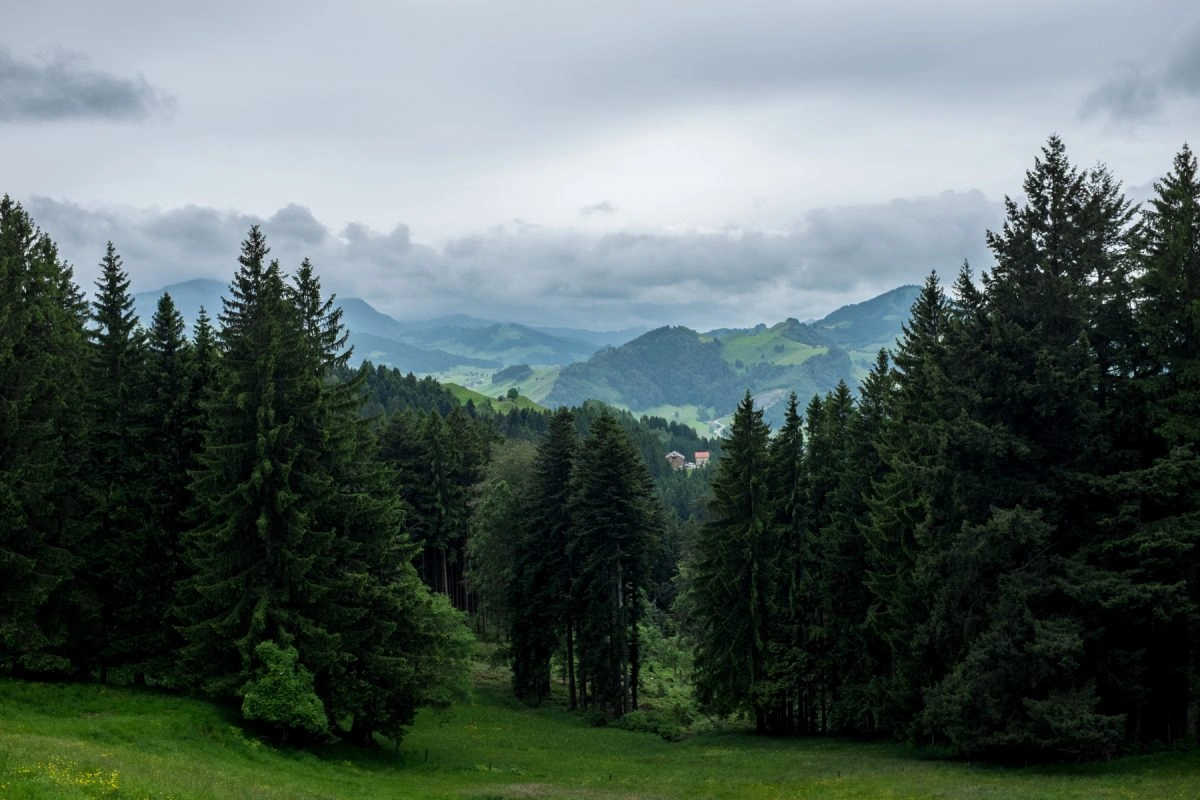
After a number of grass hills and cows we entered a forest of tall pines. From that moment on until the end of the hike I think we came across two couples over the course of the next four and a half hours.
Trogen itself is at 750m above sea level so it didn’t take us long until we reached points from where we could see kilometers in every direction.
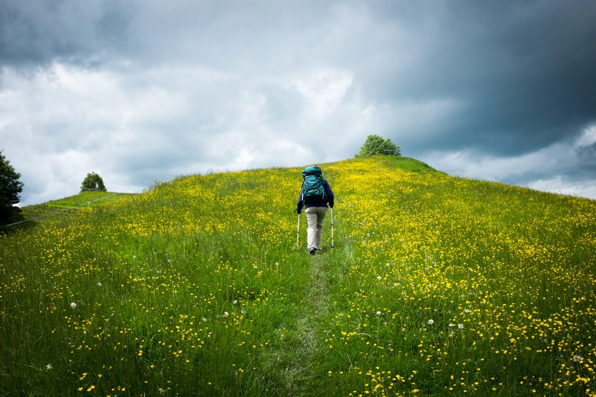
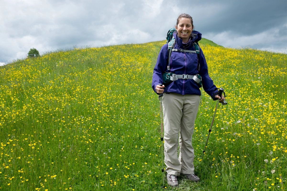
The most memorable part of this hike was the large expanse of yellow flowers (flowers are not in my circle of competence) that the photo at the beginning and the following photos show. It wasn’t the view itself what I remember most, it was the fact that the trail was completely covered with grass, it made me feel more connected to nature.
On the plus side we only got about five minutes of rain. On the downside that was more than amount of direct sunlight that we got.
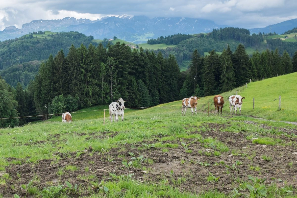
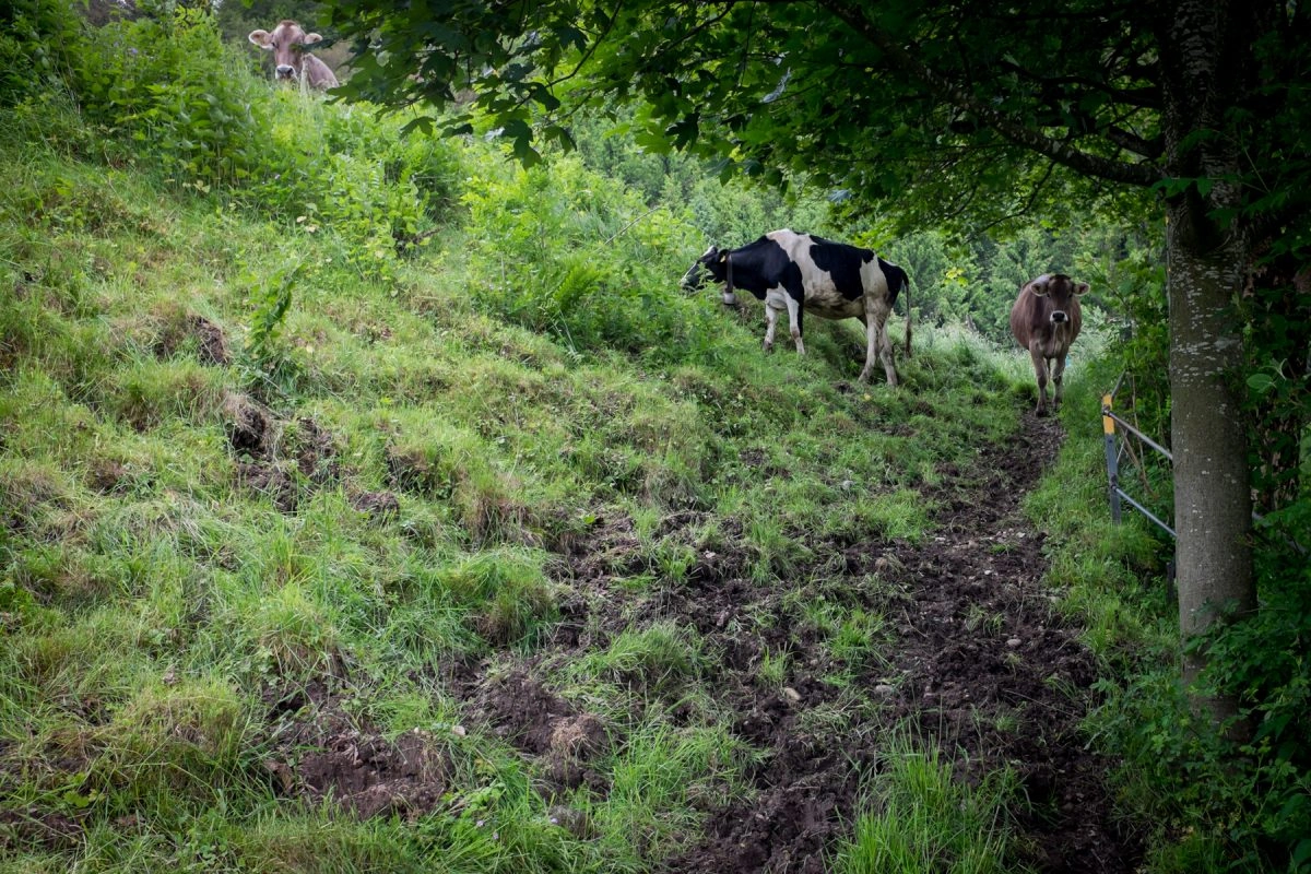
For lunch we sat down on a bench in front of a mud cow playground. It was either that or risking eating under the rain. Initially the cows in the field across us were randomly scattered but as we ate hummus the cows started to orient themselves in our direction and approach us, like those puppets in scary movies or like the Doctor Who Weeping Angels. Luckily a single thread protected us from them. When the cows finished orienting themselves the resulting scene first reminded me of Haruki Murakami’s A Wild Sheep Chase, then I started looking around for an escape route.
Our next action after lunch was getting lost. This time we didn’t take the wrong direction, somehow we suddenly were on the wrong track. All the dirt and the trail being blocked by a pile of wooden logs should have been a strong enough cue but well…
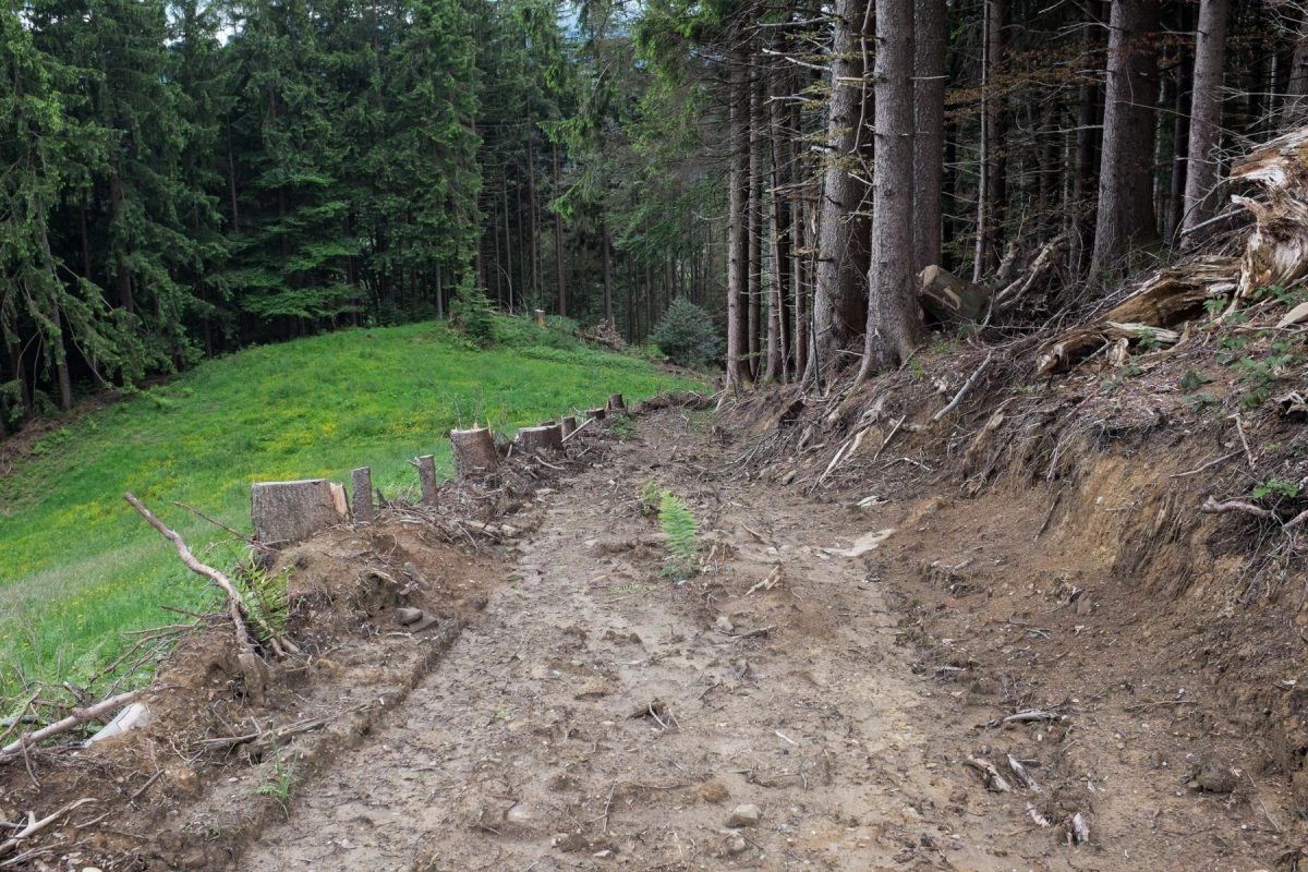
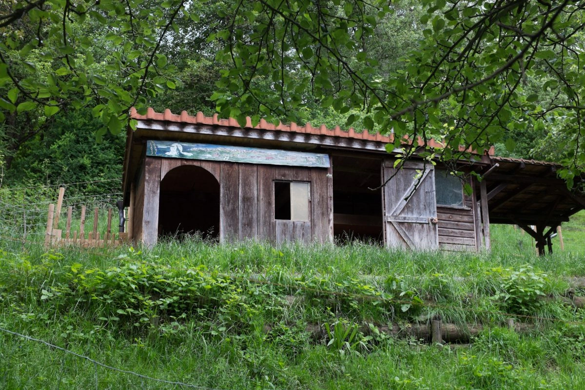
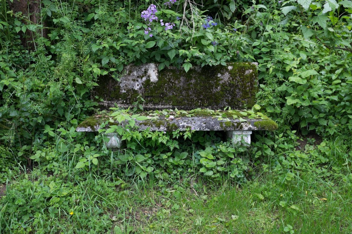
After going down a steep hill with waist-high grass we found the trail where we continued until we reached an area with several interesting items.

We left this nudist friendly area through another mud field that made us extremely grateful of wearing Gore-tex hiking shoes.
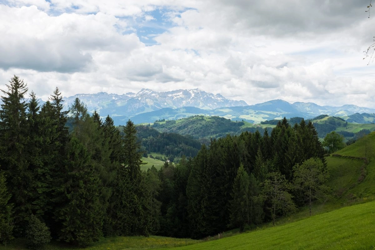
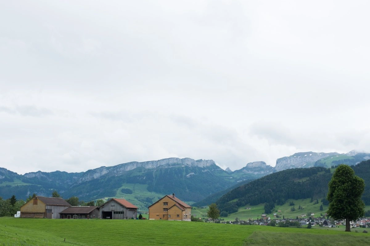
The rest of the trail took us through more rolling hills with impressive views of Mount Säntis and the mountain chain around it.


Eventually we reached the town of Appenzell, known for its wall frescos but we were quite tired so that will have to wait until the next visit.
Trail stats:
Distance: 13km (~4h20m)
This entry is part of the series Switzerland (2015 - 2020):
- Bye Bye California, Welcome Switzerland
- Schaffhausen And The Rheinfall Waterfalls
- Hiking From Wasserauen to Ebenalp
- Konstanz, Germany
- Bellinzona
- Hiking From Richterswil to Pfäffikon SZ
- Hiking From Einsiedeln To Schwyz (Via Jacobi - Stage 5)
- Hiking From Staffelegg to Brugg (Jura Crest Trail - stage 2)
- Hiking From Trogen to Appenzell (This entry)
- Hiking From Maienfeld To Heididorf
- Sense Exploring While Walking In Nature
- Hiking From Einsiedeln To Brunni
- Living In Switzerland